

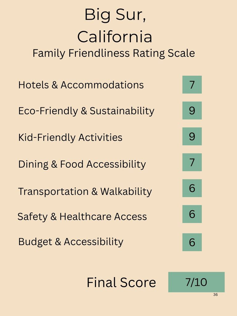
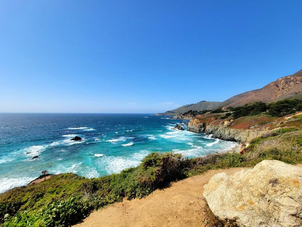
Are stunning road trips your thing? Have you dreamed about exploring the California coast? A Big Sur road trip is just what you need! With towering mountains on one side and stunning Pacific Coast views on the other, a drive along California’s Big Sur is full of big views, family friendly outdoor adventures, and plenty of opportunities for relaxation.
A Big Sur Road Trip takes you along an approximately 90 mile stretch of California’s Highway 1. The starting/end points depending on which direction you are going are Carmel-by-the-Sea (North) and San Simeon (South). On the inland side of the highway you will find the San Lucia Mountains and on the other side the Pacific Ocean.
We have compiled a list of our favorite things to do along Big Sur to help make your trip planning easier than ever!

***The Navigating Mom (and this post) may contain affiliate links. If you purchase from one of these links, we may receive a small commission at no additional cost to you.****
Best Stops Along Big Sur
A Big Sur Road Trip can begin in the North in Carmel-by-the-Sea, or in the south in San Simeon. For this road trip itinerary, we will follow the path that we took, with the starting point being near Carmel-by-the-Sea.
Carmel-By-The-Sea
Start your Big Sur road trip off by exploring Carmel-By-The-Sea. Carmel-By-The-Sea is a quaint, coastal village on California’s Monterey Penisula that is known for its views, boutiques, art galleries, cafes, and fairy-tale cottages.
Carmel-by-the-Sea is very walkable, making it a great stop for families. One of the best things to do is to visit Carmel Beach, located at the end of Ocean Avenue. You can also enjoy some downtown shopping, visit the 18th century Carmel Mission Basillica, walk along a bluffs path overlooking the ocean, or take the 17-mile scenic drive to Pebble Beach and the Lone Cypress.
Big Sur Road Trip: Point Lobos State Natural Reserve
Point Lobos State Natural Reserve is the first stop on the Big Sur drive after Carmel-By-The-Sea. Point Lobos is known for its stunning coastal scenery and is often called the “crown jewel” of California Parks. Point Lobos offers plenty of opportunity for family friendly hiking.
Point Lobos was once inhabited by the Rumsien people and in the 19th and 20th centuries was used for whaling, abalone harvesting, and granite quarrying. It was designated as a state reserve in the 1930’s.
Hiking is one of the best things to do at Point Lobos State Natural Reserve. You can choose from the 0.8 mile Cypress Grove Trail and the 0.8 mile Bird Island Trail for an easier hike. If you are looking for a little more of a challenge, consider the 2 mile South Shore Trail or the 2 mile Whaler’s Cove & Granite Point Trail.
Wildlife watching is another one of the best activities to do at Point Lobos. Common sightings include sea otters, harbor seals, sea lions, gray whales, and various bird species. You can also enjoy kayaking, snorkeling, and diving.

Garrapata State Park
Garrapata State Park is the next stop along the route, just 3 miles south of Point Lobos. The Park features 2 miles of beach front and a range of hiking trails along the beach and through Redwood groves.
The Garrapata State Park Bluff Trail is an easy 0.7 mile hike along the West Coast shoreline. The trail takes about 15 minutes to complete. The elevation gain is 72 feet. Along the trail you will be treated to stunning coastal views and a waterfall.
Wildlife watching is also a popular activity within the park, with common sightings including sea lions, harbor seals, and sea otters.
Calla Lily Valley
The Calla Lily Valley is one of the best things to do on a Big Sur Road Trip in the spring. It is located inside Garrapata State Park. It is a hidden canyon with a creek flowing through it. In the spring time comes to life with wildflowers, most notably lilies.The best time to visit the Calla Lily Valley is between February and early April. The trail to reach the Calla Lily Valley is only 0.25 miles.
Bixby Bridge
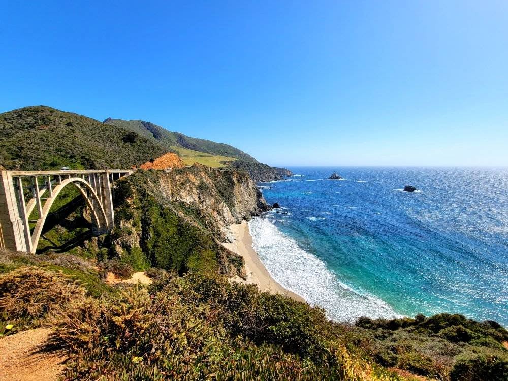
The Bixby Bridge is one of the most iconic stops on a Big Sur Road Trip. Aside from the Golden Gate Bridge, it is the most photographed bridge in California. Bixby Bridge was built in 1932 as one of the world’s tallest single span concrete bridges at 280 feet.
There are pull-offs on either side of the bridge so you can stop and admire the view, or take a few photos. The Northern pull out offers the best views. It does tend to fill up quickly, so be prepared for this. We had to drive by a couple times to get a parking spot. Bixby Bridge is about 15 miles South of Carmel-by-the-Sea.
Big Sur Road Trip: Andrew Molera State Park
Andrew Molera State Park is an often overlooked stop, but it offers some great hiking trails for those looking for a secluded, unique outdoor adventure. The Park features 20 miles of hiking trails on trails that follow along coastline, riverside, ridge line, and meadows.
The 1.7 mile Bluff Trail is a good option that connects to the Beach Trail, taking you along the coastal bluffs with views overlooking the Pacific Ocean. The Creamery Meadow Trail is another good option for families, at 2 miles round trip. The trail provides access to Molera Beach.
The Creamery Meadow Trail does require crossing the Big Sur River. In the summer a footbridge is installed for easy crossing. The beach does just about disappear during high tide, so be sure to check tide schedules when planning your trip.
Also inside the park you will find the Ranch House Museum and California Condor Discovery Center. The Discovery Center, run by the Ventana Wildlife Society, focuses on the organization’s work with the California Condor and other wildlife in the area. The Ranch House Museum highlights the history of Big Sur.
Wildlife watching is another favorite activity in the park, especially during the monarch butterfly migration from Oct-Jan. Mountain biking is another fun activity in the park.
There is a walk-in campground in the park and Big Sur Lodge is nearby if you are looking for overnight accommodations during your Big Sur Road Trip.
Pfeiffer Beach
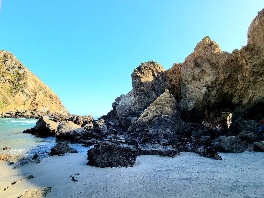
Pfeiffer Beach is one of the most unique beaches on the California Coast and a stop you don’t want to miss on your Big Sur Road Trip. The main features of the beach are the purple colored sand and the keyhole rock formation. Manganese garnet from nearby hills is what gives the sand its purple color.
Swimming at Pfeiffer Beach is not recommended due to cold water temperatures, unpredictable riptide currents, and high wands. Instead, simply enjoy and soak in the unique rock formations and purple sand.
Finding the road to Pfeiffer Beach can be tricky. It is a sharp, narrow turn. If you are heading South, you will want to take the second right after the Big Sur Station. The turn is marked with a big yellow sign that says “Narrow Road: No RV’s or Trailers.” There is a $10 entrance fee for the beach.
Grab a Bite to Eat At Nepenthe
Nepenthe is an excellent option for grabbing a glass of wine or sitting down for a meal. The restaurant sits 600 ft. above the ocean and offers some of the best views along the drive.
There are three different options-the Nepenthe Restaurant, Café Kevah, and the Phoenix Shop. The restaurant features steaks, burgers, chicken, and a vegetarian option. There is also a kids menu with kid approved foods including grilled cheese and hot dogs. For the adults, there is an extensive wine menu.
Point Sur Lighthouse
The Point Sur Lighthouse sits just off the highway in Point Sur State Historic Park. The lighthouse sits about 360 ft. above the ocean on a volcanic rock. The lighthouse was built in 1889 and has been in continuous operation since.
On select days of the week you can take a tour of the lighthouse and the former Point Sur Naval Facility. The tour is a 3 hour walking tour that involves walking on a paved road less than half a mile in distance and with an elevation gain of only about 360 feet. When planning your visit, be sure to double check to make sure tours are being offered that day.
Big Sur Road Trip: Parrington Cove
Parrington Cove is another one of the most overlooked stops on a Big Sur Road Trip. A trail leads you through a tunnel carved into the cliff side and down to a rocky, secluded cove. The cove offers some stunning California coast views, crystal clear water, and a secluded area to relax.
The hike to Parrington Cove is 1 mile round trip with an elevation gain of about 330 feet. A small green gate marks the start of the trail. It starts out as a steep dirt road that will take you to a small wooden bridge and to the tunnel. On the other side of the tunnel you will see the cove and a small bench you can sit on to enjoy the views.
(Parrington Cove is actually inside of Julia Pfeiffer Burns State Park, about 2 miles North of McWay Falls).
Julia Pfeiffer Burns State Park
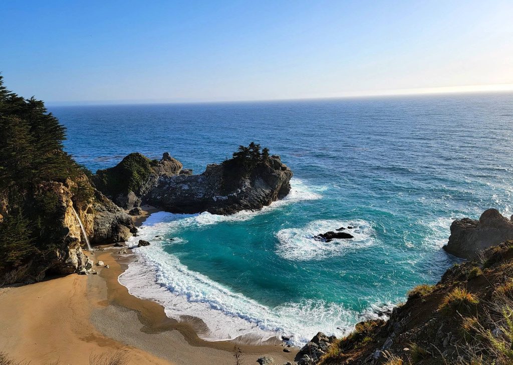
This was my favorite stop on the road trip. Julia Pfeiffer Burns State Park features the 80 foot McWay waterfall falling onto the beach, with waves crashing along the shoreline. The trail is easy, making it doable for families with young children. The park features one of the most unique views on the California coast.
There is a short walk from the parking area to the waterfall along a mostly paved/boardwalk trail. There is a decent sized parking area and a fee to visit the park. There is no beach access here, and it is actually forbidden to go down to the beach.
Limekiln State Park
Limeklin State Park offers a unique combination of Redwood trees and California coastal views. The park also gives views overlooking the Monterey Bay National Marine Sanctuary. The park contains both beautiful views and rich history, making it a great Big Sur road trip stop.
A main highlight of Limekiln State Park is Limekiln Falls. The falls is a 100 foot split waterfall that is reachable on a 1.2 mile out and back trail (considered moderate). The historic lime kilns are another main feature of the park. The lime kilns are stone furnaces built in the late 1800’s. They were used to process limestone for construction. You can reach them on an easy half mile trail.
Hiking is another popular activity in the park, with many short and easy hikes that are good for families.Camping is another option in the park, with several ocean-view campsites. There is also beach access in the park.
There is a fee to enter the park, be sure to check current pricing before your visit.
Sand Dollar Beach
Sand Dollar Beach is the biggest beach along Big Sur. It is located inside Los Padres National Forest. Sand Dollar Beach is a popular spot for surfing, and sunbathing. The beach is surrounded by high bluff tops, protecting it from the wind and making it one of the calmer beaches along the coastline.
The trail down to the beach is pretty steep. There is a staircase leading down to the beach area. There is no lifeguard on duty and swimming is not recommended due to unpredictable rip currents and cold water temperatures.
Sand Dollar Beach is open year round. At the parking area you will find picnic tables a BBQ, and restrooms. There is an entrance fee, so be sure to check current pricing before your visit. Poison oak is common in this area, so so you will want to make sure you stay on the marked trails and tell your children to look, don’t touch.
Big Sur Road Trip: Elephant Seal Vista Point
The Elephant Seal Vista Point is one of the best spots for wildlife watching on a Big Sur Road Trip, and one of the last stops before reaching San Simeon. The Vista Point has a series of boardwalks and viewing areas, easily accessible from the parking area.
Seals can be seen year-round, but peak in January, April, and October. Visiting between December and March will treat you to some extra special viewing opportunities as it is the birthing and breeding season.
Representatives from Friends of the Elephant Seal are onsite daily at the viewing area to answer questions you may have. Usual hours are 10am to 4pm, but be sure to check before your visit.
Hearst Castle/San Simeon
Once you reach the end of your Big Sur road trip, you will have the option to spend some time in San Simeon. Hearst Castle is one of the main highlights in San Simeon you won;t want to skip.
Hearst Castle was built by William Randolph Hearst beginning in 1919. Construction lasted for 30 years and what was originally going to be a simple hillside retreat turned into “La Cuesta Encantada” that included multiple buildings, gardens, and terraces.
Reservations are required and access to the castle is through a guided tour. You can purchase tickets for tours at the visitor center, but it is highly recommended to purchase them online ahead of time. There are a variety of tours to choose from, including the Grand Room Tour, Art Under the Moonlight tour, or a private tour. There are also wheelchair accessible tours available.
Other things to do in San Simeon include the W.R. Hearst Memorial State Beach, the Piedras Blancas Light Station, hiking, kayaking, strolling the San Simeon Bay’s Historic wooden pier, visiting San Simeon Beach, and looking for tidepools at San Simeon Point.
Things to Know on A Big Sur Road Trip
- Cell reception along the highway is poor. Plan ahead and know where you are going. Printing or downloading a map ahead of time can keep you from getting lost.
- You can drive the route from South to North, or North to South. Driving Southward is recommended, because you will be on the ocean side.
- Gas stations along Big Sur are limited. Be sure to fill up ahead of time.
- Fog is common in the summer months and can impair the view at stops along Big Sur. To avoid this, plan on visiting later in the day if visiting in summer.
- Parking areas tend to fill up quickly, so try to plan your visit around this. Visiting earlier in the morning can help you avoid this, but it also increases the chances of running into fog.
- Be prepared for changing weather due to mountain shade and coastal wind. Bring/dress in layers.
- Carry some cash. Many of the parks require a small admission fee, and some only accept cash.
- Bring drinks and some snacks. There are dining options available, but they are limited.
- Many of the parks have a $10 entrance fee. You only need to pay this once per day to enter state parks along the drive. You don’t have to pay at each park.
Frequently Asked Questions
How Long Do You Need in Big Sur?
While the route itself can be driven in 2-3 hours, plan to spend a minimum of a day exploring the area. To really experience all the area has to offer, plan on spending 2-3 days in the area (or more!).
When Is The Best Time to Visit Big Sur?
Spring is best for wildflowers in Calla Lily Valley, while the winter months are best for clear views (as fog tends to be less). Summer has the warmest temperatures, but you will also be fighting fog in the early mornings.
Is Big Sur a good road trip destination with kids?
Yes! There are so many scenic viewpoints, short hikes, beaches, waterfalls, wildlife watching, and redwood forests that are perfect for families with kids of all ages.
Is the drive through Big Sur difficult?
Highway 1 through Big Sur is a beautiful but winding coastal road. There are steep cliffs, narrow sections, and numerous curves, but as long as you take your time, you should have no problem with the drive!
Are there gas stations in Big Sur?
Gas stations are limited and fuel can be expensive, so it’s a good idea to fill your tank ahead of time.
Can you camp in Big Sur?
Yes. There are several campgrounds in and around Big Sur, including Pfeiffer Big Sur State Park Campground, Limeklin Campground, Fernwood Resort and Campground, and Kirk Creek Campground.
***The Navigating Mom (and this post) may contain affiliate links. If you purchase from one of these links, we may receive a small commission at no additional cost to you.****
Book Your Accommodations
Book your traditional hotel accommodations using Booking! We love booking because of the wide variety of options, that can accommodate every budget and unique family needs!
Alternatively, consider booking a VRBO and having the entire place to yourself! VRBO is another great options for families because it gives you your own space and access to essential amenities like a full kitchen.
Book Your Flight!
Book your flight using one of our recommendation resources:
Looking for More Outdoor Adventure For Your Family?
